
The short answer
When weighing drone vs surveyor on a construction site, the answer is usually a split of the work, not a swap. A drone makes sense when the job is capturing imagery and elevation data across large grades in one flight. A surveyor is still needed for legal boundary certification, precise stakeout and sign-off on as-built positions, so the best result usually pairs a drone for data capture with a surveyor for the certified and high-tolerance work.
Key takeaways
- A drone captures site imagery and elevation data across large grades in one flight, which is the data-gathering part of a surveyor's job.
- A surveyor still certifies legal boundaries, sets control and signs off on as-built positions.
- Part 107 generally limits drone flights to 400 feet and visual line of sight unless a waiver is granted.
- A drone model is only as reliable as the ground points checked against it.
- Plan the team as a drone plus the surveyor, not a drone in place of one.
Drone vs surveyor on a construction site: which makes sense?
A drone makes sense on a construction site when the job is to capture imagery and elevation data across large grades, cut and fill areas or stockpiles in one flight. It takes over the wide ground walk and repeat passes that would otherwise pull a survey crew off its other work. The output is a map, an orthomosaic or an elevation model that the team reviews in the office.
A surveyor makes sense when the work carries legal weight or a tight tolerance. Boundary certification, control setting, exact stakeout and verification of as-built positions are tasks a licensed professional signs for. A drone can inform that work, but it does not sign for it.
A drone is the wrong tool on a small lot with a handful of control points, on work that needs a sealed result, or where the airspace and weather do not allow a safe flight. Most large sites land somewhere in between, which is why the practical answer is usually a split.
What does a surveyor actually do during a shift on a construction site?
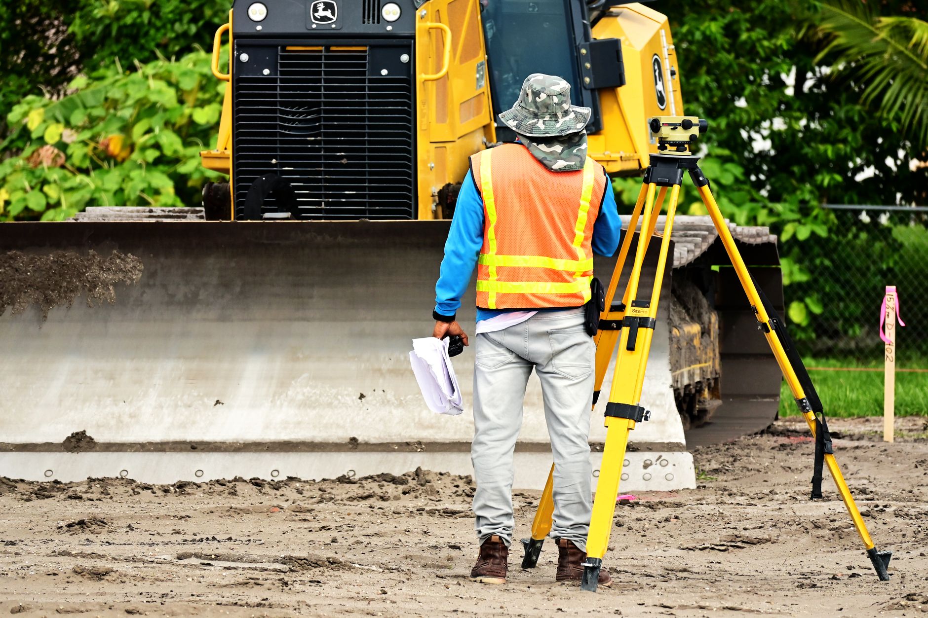
A surveyor's shift on an active site usually starts with control, not the instrument. The surveyor confirms that reference points still hold after earthwork, checks the work order and plans which stakes or checks the day needs. Because the build sequence drives the schedule, the plan often changes with the foreman's priorities.
Most of the day is physical. Surveyors set and reset stakes, read layouts, shoot points for grade and check that subgrade or forms match the design. Each point is measured with equipment, recorded and compared against the plan, and anything outside tolerance is flagged before the crew builds on it.
The paperwork is part of the job. Field notes, as-built records and reports go to the project team, and anything that touches a legal boundary needs a licensed surveyor's certification. The Bureau of Labor Statistics says surveyors typically need a bachelor's degree and a license to certify legal documents, which is why the work is hard to hand to an unlicensed crew member.
Which survey tasks can a drone take, and which can it not?
A drone is strongest on tasks that need wide coverage and frequent repeats. Aerial imagery of a whole grade, orthomosaic maps, elevation models for cut and fill, and progress documentation across a large pad are the jobs it does well. According to an ABC member survey, site progress monitoring was the top use among drone users at 80.8%, which fits this pattern.
A drone cannot set a stake, certify a boundary or confirm a point that was not measured on the ground. It also cannot see inside an enclosed structure, under dense canopy or into a trench shielded from the sky, so interior and buried work stays with the crew.
Some tasks sit in between. Tie-in points, existing utilities and property corners often need a ground measurement that the drone can guide but not replace. The practical rule is that the drone gives the team the broad picture, and the surveyor confirms the points that will be built to.
- Wide grade coverage
Drone
Captures a large grade in one flight when weather and airspace allow
Surveyor
Walks the ground point by point, which takes longer over large areas
- Stakeout and layout
Drone
Guides a crew to approximate positions but does not set stakes to tolerance
Surveyor
Sets and verifies stakes to design tolerance with instruments
- Legal boundary work
Drone
Supplies reference imagery but certifies nothing
Surveyor
Licensed surveyor certifies and signs the result
- Repeat progress checks
Drone
Repeats the same flight on a schedule with consistent coverage
Surveyor
Repeats checks, but each one takes crew time away from other work
- Tight or shielded areas
Drone
Limited under structures, dense canopy and inside trenches
Surveyor
Can work in confined areas with the right access and safety setup
- Weather and visibility
Drone
Stopped by wind, rain and loss of line of sight
Surveyor
Can keep working in many conditions under site safety rules
How much crew time does a drone survey take off the job?
The honest answer depends on your own crew logs. I did not find verified hour figures for survey tasks in this pass, so any hour saving should be measured against your own records rather than a general benchmark. The labor picture is clearer. According to the Bureau of Labor Statistics, there were about 56,100 surveyor jobs in 2024, and the projection is 6% growth for 2025 to 35, faster than the average for all occupations.
Turnover adds pressure. As reported by NRCA, the construction job openings rate was 3.4% in December 2025, up from 3.2% a year earlier, and the quits rate for the month was 1.5%. A trade press headline in mid 2025 reported that the construction quit rate had reached a nine-year low. Fewer people are leaving, but openings are rising, so a surveyor who does leave is replaced from a competitive pool.
I did not find verified figures for overtime, night shift frequency or sick days specific to survey crews, so those belong in your own timesheets. Pull the last twelve months of survey hours by task, the overtime paid on survey days and the days lost to rework. Those three numbers decide whether a drone case holds.
On cost and schedule, Construction Equipment Guide reported a hospital project in which drone mapping led to cost and schedule savings, without publishing a percentage. Treat that as direction rather than a benchmark. Vendor blogs make large speed claims, but I could not verify them, so this page does not use them.
How does a drone and surveyor team work together on site?
The working model is a drone plus a surveyor, with fewer hours on the ground and one person accountable for the result. The drone flies the capture, the surveyor reviews the data, sets and checks the control points, and decides what needs a ground check. A drone vs surveyor setup with zero surveyors on site is not a model to use for work that carries a certification or a tolerance.
Roles shift rather than disappear. The surveyor spends less time walking large grades and more time on control, checks and stakeout where tolerance matters. A trained site team member can handle launch and data upload under the surveyor's direction, but the flight plan and the data review should sit with someone who knows the survey.
Whoever flies must meet the Part 107 requirements. Give the flight a named owner, a written flight plan and a day checklist, so the data is usable when it reaches the surveyor's desk.
What are the FAA rules for flying a drone over a construction site?
Most commercial site surveys fall under Part 107 of the FAA's small unmanned aircraft rules. The FAA summary says an aircraft may not fly higher than 400 feet above ground level, except within a 400-foot radius of a structure and no more than 400 feet above its top. The aircraft must also stay within visual line of sight of the remote pilot or a visual observer.
Those limits are the ones a long grade, a tall structure or a site beside an occupied building can trigger. The FAA says its most requested waivers cover flying beyond visual line of sight, above 400 feet and over people. Plan the flight around these limits before the crew arrives, not after.
Regulatory and compliance issues were the top barrier in the ABC member survey, cited by 53.5% of respondents, ahead of training and staffing at 43.4%. On a long grade, the line-of-sight rule often shapes the flight plan more than the drone's own range does.
- Altitude: 400 feet above ground level, with the structure exception described by the FAA
- Line of sight: the remote pilot or a visual observer must keep the aircraft in view
- Waivers: the most requested cover beyond visual line of sight, flights above 400 feet and flights over people
- Verification: check the latest rule text on eCFR, because the summaries reviewed for this page were older
Does a drone reduce safety risk on a construction site?
The Bureau of Labor Statistics counted 1,032 fatalities in construction and extraction in 2024. Construction's fatality rate was 9.2 per 100,000 full-time equivalent workers, down 0.4 from 2023.
Fatal falls, slips and trips fell 7.5% to 370 in 2024 from 400, according to the same BLS tables. Construction Dive reports other totals, 1,034 construction deaths and 389 fall deaths, because outlets group the categories differently. Use the BLS tables when you cite a number to a client or insurer.
A drone does not remove the fall risk. It can, however, reduce how often a person walks an unstable slope or the edge of an excavation just to collect data. That is a planning point, not a measured result. I did not find verified data on survey-specific injury rates, so treat it as a reason to plan the flight, not a claim about incidents avoided.
Where does a drone fail or mislead on a construction site?
Drones fail in predictable ways. Wind and rain can stop a flight, and the line-of-sight rule limits a flight to what the pilot and observer can keep in view or what an approved waiver allows. Dust, reflective surfaces and tall equipment can degrade images, so a flight on the wrong day wastes time the crew was trying to save.
Accuracy is the second limit. A drone model is only as good as the ground control points and the processing behind it, and a clean-looking map can still be off where the grades matter. Measure a sample of points by ground survey before using the model for cut and fill, and keep those checks in the record.
Certification is the third limit. Drone output does not carry a surveyor's seal and cannot support a boundary or easement decision alone. Where a job needs a legal result, the surveyor stays on it and signs. Underground utilities and enclosed spaces are also outside what the drone can show, so they still need a crew.
How do you start a drone survey program on an active site?
Start with one bounded test, not a full program. Pick one grade or pad where you already know the crew hours and the rework, fly it on a set schedule, and compare the data with points the surveyor measured on the ground. A single site test gives you a result you can defend to the client and the insurer.
We are a commercial robot integrator, and our process starts with a free site assessment. We map the survey tasks, decide which the drone takes and which stay with the surveyor, and then quote a lease once that plan is clear. We pick the unit that fits the site, deploy and integrate it into your workflow, train the staff who will fly and review it, and service it nationwide.
Keep the surveyor on the team from the first flight. The test should show which points the drone can replace and which still need a measured check, and that answer sets the survey team size you need. A practical path is to start with one leased unit and widen the scope only after the crew hours and rework figures hold up.

Frequently asked questions
Upcoming builders & gcs events
- ExpoConstructing Industry Connections Symposium & ExpoNov 18, 2026Pennsylvania Farm Show Complex, Harrisburg, PA
- Trade showAPC/PennDOT/PA Turnpike Fall SeminarNov 18 to 20, 2026Hershey Lodge, Hershey, PA
- ExpoPittsburgh Remodeling ExpoFeb 5 to 7, 2027Acrisure Stadium, Pittsburgh, PA
- ConferenceHealthcare Project Delivery Conference 2027Feb 10 to 11, 2027Manchester Grand Hyatt, San Diego, CA
Want a drone at your construction site?
Tell us about your site. We will recommend the robot, quote the lease, and keep it serviced.
Sources
- BLS Occupational Outlook Handbook: Surveyors
- BLS Census of Fatal Occupational Injuries tables
- ABC member survey on drone use on jobsites
- NRCA report on construction job openings (JOLTS)
- FAA small unmanned aircraft systems (Part 107) summary
- Construction Equipment Guide: drone mapping hospital project case
- Construction Dive: construction fatalities 2024
- New England Construction: construction quit rate at nine-year low