
The short answer
Drone cost for cranberry bogs depends mainly on how many wet acres a grower must survey, how often flood and frost scouting falls on short notice, and how the flight plan, mapping and service fit the layout of each bog. Acreage sets the base workload, but the timing of water and frost events decides how many flights a season needs and how fast the results must come back. The lease quote is set after a free site assessment that measures those factors on your own bog.
Key takeaways
- Wet acreage and bog layout set the base workload for any drone scouting program.
- Flood and frost timing decides how many flights a season needs and how fast results must arrive.
- Flights beyond visual line of sight need an FAA waiver, which adds conditions and a term to the plan.
- Mapping, software, maintenance, insurance and training are easy to miss and should be named in the quote.
- A free site assessment turns those factors into a lease quote for your bog, not a generic figure.
What does drone cost for cranberry bogs depend on?
Drone cost for cranberry bogs depends on a short list of site facts: the wet acreage to be surveyed, the number of separate beds and dikes, how often scouting must happen during flood and frost periods, and whether flights have to go beyond the operator's line of sight. Each one changes the equipment, the flight time, the regulatory path and the service load.
Growers often start by asking what the aircraft costs, but the more useful question is what job it must do each season. A drone that flies fixed routes on calm mornings is a different lease from one that must launch on short notice during a cold night and return usable images before the water is set. The lease is built around that job, not the aircraft alone.
This page covers each cost factor, the hidden costs that surprise people, the FAA rules that affect remote flights, how leasing through financing works, and how a quote is set after a free site assessment. Where the research did not establish a figure, the page says so.
Which factors move the cost up or down on a bog?
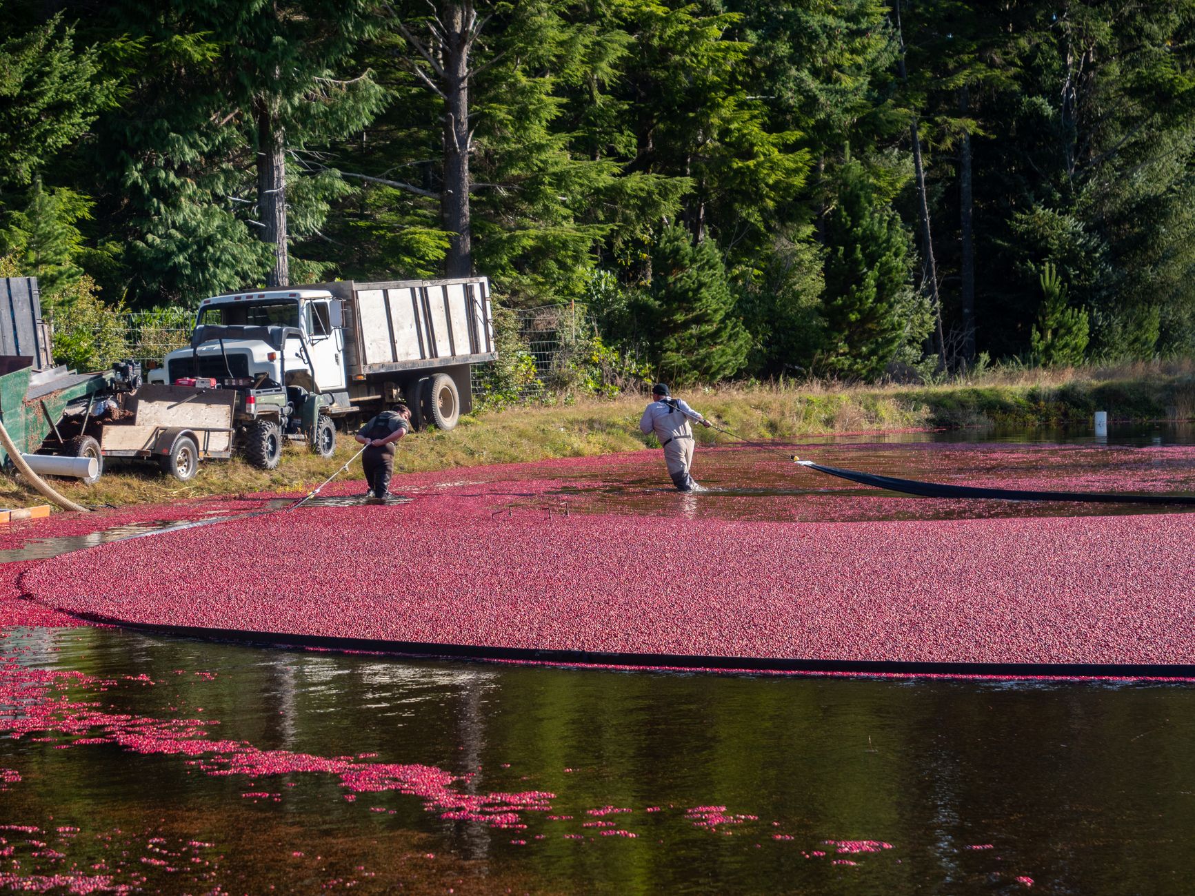
Acreage is the anchor. A cranberry bog is a set of beds divided by dikes and ditches, and a flight plan must cover every bed that can flood or freeze. More wet acreage means more flight time per survey and more images to process. Irregular shapes and many small blocks add turns and battery swaps, so a modest total acreage can still carry a real workload.
Timing sets the number of flights. Flood removal and frost events do not follow a calendar, so a survey may be needed on a cold night and again the next morning. UMass Amherst guidance warns growers not to cut scouting so far that outbreaks are missed, which means the schedule is a real cost driver rather than a convenience.
Range and waivers matter. A flight kept within the operator's sight needs fewer approvals than one that flies beyond it, and remote acreage often pushes flights past that line. Obstacles such as power lines, trees, pump houses and structures along dike edges change the route, the altitude and the safety margin, and each change adds planning time.
How much cranberry acreage is there in the US?
The USDA Economic Research Service projects the 2025 US cranberry crop at 8.13 million barrels, down 9% from 2024 and close to the 5-year average of 7.95 million barrels. A barrel is 100 pounds. Output is a useful signal of how much bog is in production, though it is not the same as scouting workload.
Production varies widely by state. The same ERS projection puts Wisconsin at 5.3 million barrels for 2025, down 3% from 2024, while Massachusetts is projected down 22% to 1.75 million barrels. Oregon and New Jersey also fell by double digits. A smaller crop does not reduce the frost or flood risk on the beds that remain, so the scouting job does not shrink in step with output.
We did not find a 2025 harvested-acreage figure in our research, so this page does not state one. For a specific bog, the acreage by block from the grower's own records is the number that matters, and the site assessment checks it on the ground.
How do flood timing and frost scouting change the workload?
Growers protect beds with water, and the water has to be set and removed on the right days. UMass Amherst advice from a 2000 best management practice document says to protect the bog only when frost is imminent, and to start irrigation before the tolerance threshold is reached, with sensors and alarms set to match. Sensors and alarms only help if someone checks the bed conditions in time.
Late water adds a second risk. The same UMass document advises setting sprinkler heads in place before the flood, so the grower can respond if a frost night follows flood removal. An older Wisconsin horticulture note advises growers to watch conditions closely and re-flood if necessary until frost is out to a depth of one inch.
The 2014 UMass Amherst cranberry production guide calls cycling irrigation strongly recommended to save pumping costs where equipment allows, so the water schedule also sets pump run time. Each change in the schedule changes when scouting is needed.
Aerial survey fits this work because the job is pattern finding across a large area. An image from above can show where water stands, where vines look stressed and where frost has settled, and a crew can then walk the flagged blocks. We did not find a published study measuring aerial scouting speed or accuracy on cranberry bogs, so treat the fit as a hypothesis to test on your own site.
How many hours does scouting take, and what does a drone change?
Our research did not find verified grower labor hours, crew sizes, staffing levels or turnover for bog scouting or flood management, so this page does not quote them. Anyone building a plan should time the current walking on their own bogs during a real cold night and bring that record to the site assessment.
The only timed flight figure in our research comes from a 2021 University of Florida IFAS Extension article about citrus, not cranberries. It reports that a quadcopter mapped an 11-acre citrus section in just under half an hour using two batteries. The same article describes a colleague's fixed-wing drone mapping 200 to 1,000 acres per hour, and presents these as practitioner claims rather than results from a controlled study.
Translate those figures carefully. Flight speed depends on the crop, the sensor, the terrain and the battery plan, and a bog with many dikes and short blocks will not match a flat citrus block. The table below shows the kind of work that changes, not a promised time.
What FAA rules affect drone flights over remote bogs?
A drone flown within the operator's visual line of sight follows the standard small unmanned aircraft rules under Part 107. Flights beyond that line need a waiver. The FAA 2025 Certificate of Waiver example in our research shows beyond-visual-line-of-sight operations are approved one waiver at a time, and the waivers typically waive 14 CFR 107.31 and often 107.33, which concerns visual observers.
The example certificate runs from December 5, 2025 to December 4, 2027, so a waiver has a term and must be renewed or replaced. The waiver does not grant airspace authorization under 14 CFR 107.41, which must be obtained separately. Some waivers require detect-and-avoid technology, and some require FAA approval of UAS service supplier services.
We did not confirm the status of the proposed beyond-visual-line-of-sight rule, so the quote reflects the rules in force when it is written. Remote bogs are often where a waiver matters most, because the observers and the flight path may be far apart.
How does leasing a drone through financing work?
We lease robots through financing, so an operation avoids a large upfront capital outlay and pays a fixed robot lease payment set in the quote. A grower can start with a limited scope, such as one or two bogs or a single frost season, and expand once the flight plan has proven itself on the beds.
The quote is built after a free site assessment. We measure the wet acreage, the bog layout, the flood and frost schedule, the airspace and waiver needs, and the data the grower wants back. The quote lists the fixed lease payment, the deployment and integration work, staff training, the maintenance and service terms, and anything that sits outside the lease.
Lease financing programs and terms vary, so ask for the term length, what happens at the end of it, how spare units are handled and the response time for an emergency. Our service covers on-site dispatch and remote triage, and a backup robot program can keep a frost night from depending on a single aircraft where the site warrants it.
What can a drone not do on a bog, and how do I get a quote?
A drone does not replace the grower's judgment or the crew's ground checks. UMass guidance warns against cutting scouting so far that outbreaks are missed, and aerial images show patterns rather than every problem. The sensor and the flight altitude limit what can be seen, so the plan should state which problems the aircraft is expected to catch.
Weather and wind limit flights, and waiver conditions set limits on how a beyond-sight flight is run. A drone cannot control the water, the pumps or the sprinklers. It informs the decision, and the grower still sets the schedule and the response.
To get a quote, request a free site assessment. Bring the bog map, acreage by block, the flood and frost calendar and any airspace or waiver concerns. The quote follows the assessment and states the fixed lease payment in writing, with each included item named.
Frequently asked questions
Want a drone at your cranberry bog?
Tell us about your site. We will recommend the robot, quote the lease, and keep it serviced.
Sources
- USDA Economic Research Service, charts of note on the 2025 cranberry crop
- UMass Amherst frost management best management practice (2000)
- UMass Amherst cranberry production guide
- Wisconsin horticulture note on frost and re-flooding
- University of Florida IFAS Extension scouting article (2021)
- FAA Certificate of Waiver example for Part 107 operations (2025)