
Key takeaways
- Drones can fly wellhead pads, access roads and pipeline corridors on the same route each time, so changes show up between ground visits.
- Drones document surface conditions. They do not replace ground crews or the instruments that read pressure, gas or the inside of a pipe.
- According to the EIA, 414 existing underground natural gas storage fields were in the U.S. as of December 31, 2024, so the repeat inspection workload is wide.
- Routine flights beyond visual line of sight still depend on a federal rule that was pending in the latest reporting we reviewed.
- Savings depend on your route count and the ground trips you avoid, so measure one pilot route before you scale.
How can drones for gas storage fields help?
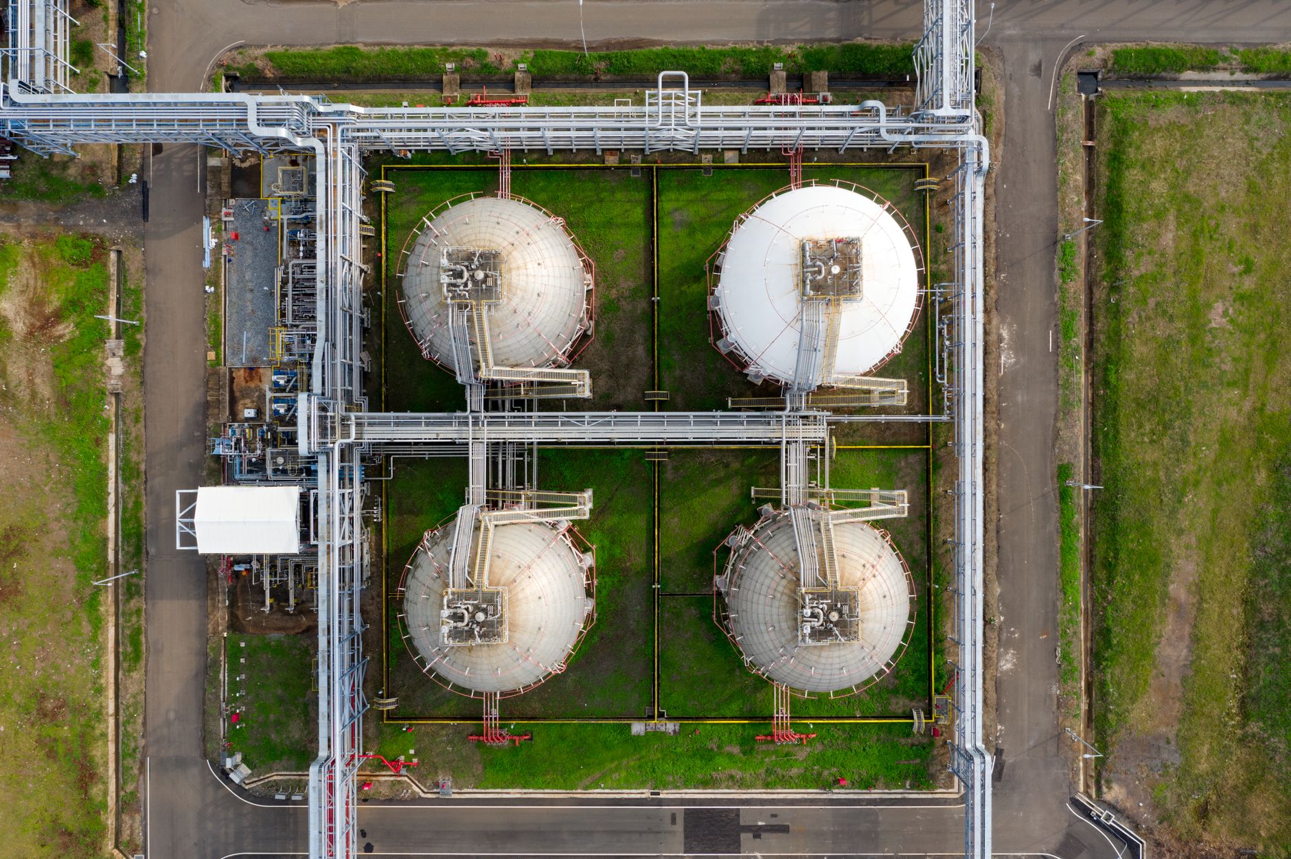
Drones for gas storage fields earn their place on the parts of a site that are wide, spread out and checked again and again: wellhead pads, access roads and the pipeline corridors that link them. A drone flies the same route each time, recording the same pads and roads from the same heights and angles. The operator can then compare one flight with the last and see what changed between ground inspections.
A drone does not replace the ground crew. Crew members still walk the pads, check equipment and make the calls that need a person on site. What the drone adds is a steady visual record of the ground between those visits, so the crew can go first to the pads and roads that changed instead of starting every cycle from the gate.
That shift in where the crew starts is the real gain. A field that used to be walked in the same order every week can be walked in the order that matters this week, with the time saved going to repairs and to the sites that need hands on them.
How many storage fields are there, and what does that mean for inspections?
According to the U.S. Energy Information Administration, 414 existing underground natural gas storage fields were in the country as of December 31, 2024. Of those, 328 were depleted fields, 47 were aquifer fields and 39 were salt cavern fields. Each type has its own layout and pressure history, but all of them share the same surface job: keeping pads, roads and piping in good condition across a large footprint.
For an operator, that number frames the inspection workload. A company that runs several fields repeats the same visits each season over ground that does not shrink. Use the national count as context only. Build your own route list from your site maps and from the pads that have caused trouble before.
What makes checking a storage field hard today?
The hard part is distance and repetition. A field can have many wellhead pads spread over ground that is not all paved, and a crew drives gravel or dirt roads between them before it can inspect anything. Each visit uses time that could go to repairs or other work, and weather can close roads or make walking unsafe for stretches at a time.
Pipeline work shows the same pattern. An academic paper on UAV pipeline monitoring says manual inspections of one operation can take several days or months. A storage field is a separate system, but the lesson carries over: the more ground covered on foot or by truck, the longer each cycle takes, and the more likely a change is missed between visits.
Labor is part of the picture too. According to the Bureau of Labor Statistics, May 2017 data for plant and system operators in other pipeline transportation, about 2,610 workers were counted in that grouping. The data is dated and covers a broader group than storage fields, but it shows how small the pool of trained people can be, so every hour lost to driving matters.
What are the main benefits of drones here?
The first benefit is consistency. A drone flies a set route with the same altitude, heading and camera angle every time, so the images line up from one flight to the next. That makes change easy to spot: a new puddle at the edge of a pad, a slumped shoulder on an access road, or a gap in a fence line.
The second benefit is coverage. Drones can document pipeline corridors and roads that a truck cannot reach easily, and they give the office a visual record that a crew can review without driving out. Gas utilities are testing the idea on large networks. According to Gas Processing News, a Virginia gas utility planned drone flights for right-of-way assessments, with 5,500 miles of gas pipeline in scope, in April 2022.
The third benefit is preparation. A crew that knows which spot changed arrives with the right parts, the right permissions and a plan, instead of a general walk through the site. The record also helps at budget time. A dated set of images for each pad and road shows which areas have changed over several seasons, so the case for repair work rests on a visible history rather than memory.
How does a drone work on a site day to day?
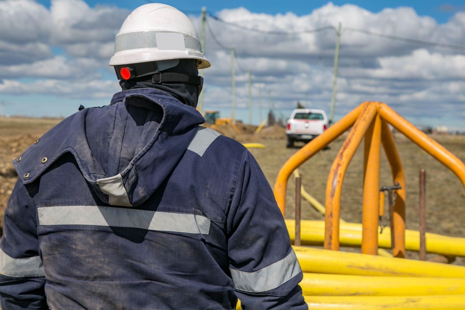
The job starts before the aircraft leaves the truck. The site team sets the route on a map of wellhead pads, access road segments and pipeline corridor sections, with altitude and stop points for each leg. Someone checks the aircraft, confirms the route against the airspace rules for that location, and assigns a person to keep visual contact during the flight.
After landing, the images and video are uploaded and compared with the last flight on the same route. A trained team member reviews the flagged areas and sends the crew only where something has changed. Repeat flights make small changes visible early, and the record builds a history for each pad and road that helps at the next season's inspection.
A typical flight day is short and repeatable. The crew sets up in the same spot, flies the same loop, lands, and reviews the results before the next task. Wind and weather decide whether a planned flight goes ahead, so the schedule always keeps a ground route as the fallback.
Which parts of a storage field does a drone cover?
Most of the value sits in a handful of ground types: the wellhead pads, the access roads that reach them, the pipeline corridors that run between sites, and the fence and drainage lines around the outside. Each needs its own route and camera angle. A pad is best flown on a steady pass high enough to show the whole footprint, while a road is best flown lower along its length to show ruts, washouts and culverts.
Compressor and station yards and the perimeter are good second tier routes. Fence breaks and blocked culverts can both go unnoticed between visits, and both are easy to see from above. The goal is not to fly everything every time. It is to pick the areas where ground checks are slow, hard to reach or easy to miss, and fly those on a repeatable schedule.
Who works alongside the drone on site?

A drone does not run the field alone, and it does not replace the people who know the ground. A trained operator, usually from the existing field or maintenance team, flies the routes. The people who already manage pads and roads decide what to do with each finding, so the drone changes how the team spends its hours, not the need for the team.
We are a US commercial robot integrator. We choose the right robot for the site, lease it through financing, deploy and integrate it into your routes, train your staff and service it nationwide. For a storage field, that means building routes with your team, teaching the people who fly and review the data, and keeping the aircraft serviced after go live.
The crew that flies and reviews the data needs training and a clear sign off process. Staff keep the decisions, and the drone supplies a consistent view so those decisions rest on the same evidence each time.
What drives the savings, and what is still unknown?
Savings come from fewer unplanned ground trips, faster identification of changed conditions, and a smaller share of crew hours spent walking routes that have not changed. The size of that effect depends on how many pads and road miles you cover, how often you fly, and how many ground checks the drone replaces.
Our research did not find a verified hours-saved figure for drone surveys of storage fields, so we do not put a number on the savings. The workforce figure from earlier is a reminder that your hours are scarce. The route log you keep for one season is the number that will matter for your site, so measure it before deciding how far to take the program.
What can a drone not do, and what do the rules say?
A drone sees the surface. It can show a pad, road, fence line or corridor from above, but it does not open a valve, read pressure, check the inside of a pipe or detect gas by itself. A PHMSA-funded project debriefing on pipeline sites concluded that drone inspections were hard to justify financially except in the most complex terrain. That is a fair test for any storage field: the program has to fit your ground.
Rules matter too. Routine flights beyond the pilot's visual line of sight are the main open question, and the rule that would ease them was still pending in the most recent reporting we reviewed, from mid-September 2026. The FAA sent the final text to White House review on July 10, 2026, and says it hopes to publish before the end of 2026. The statutory deadline of January 16, 2026 and an executive order deadline of February 1, 2026 have both passed, so plan around the rules that apply on the day you fly.
Expect limits from weather, daylight and airspace near busy facilities, and plan for them on each route.
How do we get started with drones for gas storage fields?
Start with a free site assessment. We walk the site with your team, map the pads, roads and corridors you want covered, and note the obstacles, airspace limits and ground conditions that shape each route. The aircraft is leased through financing, and the payment comes in the quote, which follows the site assessment. We review the robot lease options with you at that point.
Begin with one route on one group of pads, run it for a full season, and count what changed and how many ground trips it replaced. A pilot route is the lowest risk way to learn whether the program fits your ground. From there, expand route by route, with spare coverage for the times a unit is in service. Bring your inspection schedule to the assessment, and ask for a demo before you commit to a lease quoted after a site assessment.
Frequently asked questions
Want a drone at your gas storage field?
Tell us about your site. We will recommend the robot, quote the lease, and keep it serviced.
Sources
- U.S. Energy Information Administration, Natural Gas Annual, Table 13
- U.S. Bureau of Labor Statistics, OEWS May 2017, NAICS 486900
- Gas Processing News, Virginia gas utility to deploy drones to inspect gas pipeline
- PHMSA-funded project debriefing, Appalachian pipeline drone study
- arXiv, UAV pipeline monitoring paper
- Low Altitude Economy, FAA Part 108 OIRA review
- Low Altitude Economy, FAA Part 108 statutory deadline